
North Florida Gulf Coast · Production Geography
Where We Work
Listing films, photography, drone and FPV, vacation-rental campaigns and construction documentation — for one coastline, from Destin's harbor to the marshes of the Wakulla coast, with the dune lakes of 30A and the barrier islands of the Forgotten Coast in between. Based in North Florida. Travel beyond it, scoped up front.
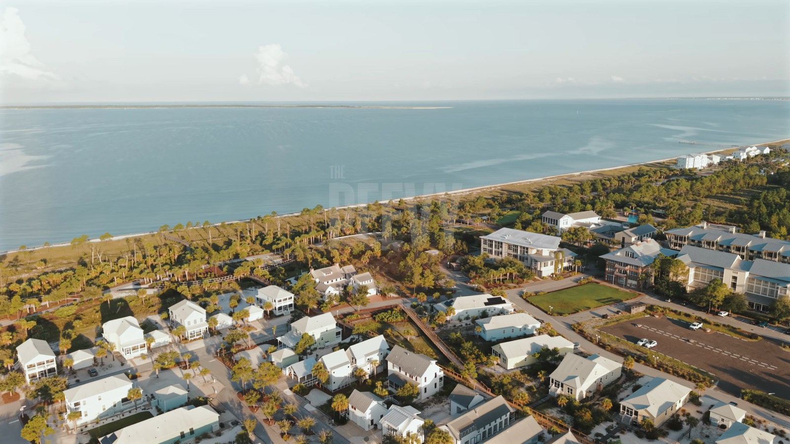
Frame — Aerial openGulf Coast, FL
What We Produce Here
One Coast. One Crew. Every Format.
Along this coast we produce the media that sells property and fills calendars: cinematic listing films and HDR photography for agents and brokerages, drone and FPV coverage that puts a home in its setting, vacation-rental campaigns for managers and owner-operators, and monthly progress documentation for builders and developers. Ground, gimbal and aerial run as one production, and every video production delivers horizontal and vertical cuts from the same shoot day.
The work is planned by people who know the difference between a beach that needs a county vending permit and one that does not, between a community that allows aerials and one that never will, and between a sunset that lands over the water and one that lands behind the dunes. Every market we work is named below — where it sits, who buys this kind of media there, what we produce, and what is different about it.
FAA Part 107 Certified & Insured
Who We Work With
- Listing agents and brokerages — Gulf-front, bay-front and community listings that need more than MLS coverage.
- Rental managers and owner-operators — Portfolios booked direct and on the platforms — media built for the booking decision.
- Builders and developers — New construction, master-planned communities and public projects that need a clean visual record from groundbreak to completion.
- Hospitality and working-waterfront brands — Inns, resorts, marinas, restaurants and destination bodies whose next guest starts with a photo.
The Corridor
Six Counties. One Shoreline.
"North Florida Gulf Coast" is our phrase for one continuous shoreline from Destin to the Wakulla coast that changes character — and regulations — at every county line. West to east, every market we work directly. Two have their own pages.
Okaloosa & West Walton Central time
Destin
The west end of our corridor. Destin's Gulf front and harbor sit inside Destin Executive's Class D airspace, so an aerial is arranged with the FAA before the shoot day, not the morning of it; the city's beach code bars aircraft from operating on or from the sand — we read that to include drones — so launches come from owner-authorized upland property.
This is media for condo associations and rental managers on the Gulf front, and for the hotels, charter operators and resort brands around HarborWalk. Okaloosa counts 16,670 lodging units, forty-five percent of them condos, and its tourism office is asking partners to keep their photography fresh. We produce harbor and charter branded content, resort campaign media, and listing work for the towers and harbor-side homes.
Miramar Beach & Sandestin
Across the county line in Walton — Scenic Gulf Drive and the Highway 98 beach neighborhoods west of 30A, under Walton's Chapter 22 beach code and, by the FAA's published boundaries, mostly east of Destin's Class D inside the Part 93 corridor. Sandestin is gated, with more than 1,200 rental accommodations by the resort's count, and its rental owners buy their own listing photography — media produced on owner or manager authorization.
Bay County Central time
Panama City Beach
The corridor's vertical market: one Front Beach Road–Thomas Drive strip from Lake Powell to St. Andrews State Park, where the visitor-spending model the CVB commissions from Young Strategies shows condo and rental lodging out-earning hotels roughly two and a half to one in spring 2025. Condo listing agents, tower and rental managers — every short-term rental inside the city limits must carry a city Vacation Rental Certificate — and the developers behind the Front Beach Road redevelopment and the Latitude Margaritaville build-out on Highway 79 — that is who this media is for.
We produce tower and amenity-deck aerials, stacked-unit listing media and monthly progress documentation, with the quieter dune-lake west end — Laguna Beach, Sunnyside, Carillon, Camp Helen — as the counterpoint. By the FAA's published boundaries the beach lies outside ECP's Class D and, at every point we sampled, outside Tyndall's airspace; we read the sectional and the day's NOTAMs before every flight, clear the on-sand position with city or Bay County code enforcement depending on the address, and have gear off the sand by 7 p.m.
Mexico Beach
Bay County — not Gulf County — and Central time, an hour behind Port St. Joe eleven miles east. Rebuilding low and strong after Hurricane Michael: a charter-locked 32-foot residential height cap, floors set at least a foot and a half above the base flood elevation under the city's 2024 floodplain code, and a beach rebuilt in spring 2025 with more than a million cubic yards of dredged sand, by the contractor's count.
The work that fits here would be for the city — a FEMA-funded pier and jetty rebuild and an FWC-backed boat-ramp expansion sit on its project board — the builders at Salt Creek on the west end and the new cottages off 15th Street, the rental managers, and the rebuilt beachfront resort. Progress documentation comes first, then elevated-new-construction listings — pilings, decks and the view, told by aerials and interior FPV because there is no skyline. By the FAA's published boundary, Tyndall's no-drone zone ends a few hundred meters west of the city limit; the town lies outside it, and we read the day's NOTAMs before every flight. No dogs on this sand.
Gulf County Eastern time
Cape San Blas & Indian Pass
A west-facing peninsula whose northern half is state park, beaches the county markets as pet-friendly, and a federal refuge across the pass — for rental managers, Cape and Port St. Joe brokerages and remote owners. Rental campaigns, listing films and drone + FPV planned from the property line outward, with the sunset over the Gulf for most of the year.
Open the Cape San Blas page →
Port St. Joe & WindMark
The county seat and its working bayfront, and the St. Joe Company's master-planned WindMark Beach north of town with D.R. Horton phases under way. Eastern time starts at this county line — Mexico Beach, eleven miles west, is an hour behind — and Tyndall's no-drone zone ends well to the west. Builders, developers, commercial and hospitality work: monthly progress aerials, model-home and amenity media, bayfront listings.
Port St. Joe on the Cape San Blas page →
Franklin County Florida's Forgotten Coast · Eastern time
St. George Island
A barrier island reached by the bridge from Eastpoint: the state park at the east end and the gated Plantation at the west end, with 525 homes, more than half in rental use. This is media for the island's rental managers, Gulf-front and Plantation listing agents and the island's inns: weekly-rental campaigns and listing films.
Aerials launch outside the state park and on owner authorization inside the Plantation; nothing stays on the public beach from 9 p.m. to 7 a.m.; beach fires are barred through turtle season. By our solar-geometry read the Gulf beach faces roughly south-southeast, so the money light is sunrise over the water and sunset over the bay.
Apalachicola
The county seat: a National Register historic district since 1980, the town's inns, and an oyster fleet with a second wild-harvest season set for October 2026 to February 2027. Hospitality campaigns for the inns, historic-renovation progress documentation under the city's Certificate of Appropriateness review, and working-waterfront brand films timed to the harvest.
Eastpoint
The mainland town across the bay — one of North Florida's last working waterfronts in the county's words, its seafood and oyster hub, and the base for some of the island's rental companies. Bay-side brand and documentary content for the seafood houses and the county's own waterfront projects, progress documentation, and bayfront listings.
Carrabelle & Lanark Village
A marina town — The Moorings, Carrabelle's largest marina by its own account, Carrabelle Beach's county park in the lee of Dog Island, St. James Bay's Audubon-sanctuary course — with Lanark Village next door, a 1955 community built from Camp Gordon Johnston's converted officers' quarters. Marina and resort media, vacation-rental listing sets and boating-lifestyle content for the operators and managers working the sound. Dog Island is a backdrop, not a location: private, preserve, boat access only.
Alligator Point
The county's east end: eight miles of coast roughly an hour from Tallahassee by Visit Florida's reckoning, a marina, and no restrooms or lifeguards at the beach accesses. Summer water runs green-brown with two to four feet of visibility — the tourist council says so itself — so the honest brief is fall-to-spring aerials of the peninsula and Alligator Harbor, for the rental managers and custom builders who work the Point. Bald Point State Park, at the Ochlockonee Bay end, allows no take-off or landing.
Wakulla County Eastern time
St. Marks, Panacea & the Wakulla Coast
The east end of our corridor, about thirty minutes south of Tallahassee by the county's own description: St. Marks, Panacea, Shell Point and Ochlockonee Bay — marinas, a marine laboratory and canal-front homes with docks, set against forty-three miles of refuge shoreline and roughly three miles of sandy beach. The buyers here are property people and working-waterfront businesses, not resorts: canal- and river-front listings, aerial documentation of docks, seawalls and canal work — the elevation story after Helene's 2024 surge — and brand or documentary pieces for the marinas, the aquarium and the county.
Two hard lines: the St. Marks refuge — lighthouse included — prohibits drones, and the county's three state parks, plus Bald Point across the bay, allow no take-off or landing. The coastal towns themselves sit outside Tallahassee's Class C by our read of the FAA dataset, flown from owner-authorized property after the day's NOTAM check.
Inland Direct Coverage Eastern & Central time
Tallahassee & Marianna
Direct markets as well, inland from the coast. Commercial, brand and event work in Tallahassee — commercial and brand production, corporate events — and builders and residential agents in Marianna. Real service areas, worked less often than the coast.
Production Notes
What Changes Between the County Lines
The Clock
Okaloosa, Walton and Bay counties keep Central time. Gulf County's coast, Franklin and Wakulla keep Eastern — Port St. Joe runs an hour ahead of Mexico Beach, the next town west. Sunrise calls, sunset windows and client meetings are scheduled in the time zone of the property.
The Airspace
Every flight is a Part 107 operation with a local layer on top: Destin's Class D, where an aerial is arranged with the FAA in advance; Eglin's Part 93 corridor over Miramar Beach and South Walton; Tyndall's restricted areas and no-drone zone beside Panama City Beach and Mexico Beach; the parks, forest and refuges from the Cape to St. Marks, where launching and landing are barred without the managing agency's authorization; Tallahassee's Class C north of the Wakulla shore. We read the current sectional and NOTAMs before every flight and tell you what is possible at your address before we quote it.
The Beach
Walton County's Chapter 22 beach code requires a vendor permit for any service offered on the sand — photographers included, on its 2026 forms. Destin, Panama City Beach and Mexico Beach run their own city codes: aircraft kept off the sand, a 7 p.m.–7 a.m. Leave No Trace curfew, a peddler ordinance. Gulf County, and Franklin County on St. George Island's public beach, add Leave No Trace rules of their own, and turtle-lighting rules with a May-through-October nesting season govern beachfront exteriors from Destin to the Forgotten Coast. We confirm each county's position before a hired shoot goes onto the sand.
The Light
South Walton's beach faces roughly due south, so for much of the year the sun sets up the beach rather than over the Gulf; by our reading of the solar geometry, the over-the-water sunsets belong to the cooler months. Cape San Blas faces west — Gulf County calls itself the only Panhandle county with a westward-facing sunset — and puts the sun over the Gulf for most of the year; St. George Island, by the same reading, faces south-southeast, so its water light is sunrise. Twilight scheduling follows the geometry of the property, not a generic sunset time.
Beyond the Corridor
Travel Projects
Projects beyond these markets are travel projects. Put the location in your inquiry and travel is planned and priced into the quote up front — no surprises on the invoice.
FAQ
Coverage, Answered
Do you have an office in each of these towns?
No. Alturax is based in North Florida and comes to the property. There is no storefront, no local branch and no public phone line — inquiries come through the form or by email, and the crew travels to the shoot. Who you are hiring is on the About page. What we do keep local is the knowledge: the permits, community policies, airspace and light that differ from one stretch of this coast to the next.
Which markets have their own page?
Two so far: Scenic Highway 30A, and Cape San Blas, Indian Pass and Port St. Joe. Every other market above — Destin, Panama City Beach, Mexico Beach, St. George Island and the rest of the Forgotten Coast, the Wakulla coast — is direct coverage with its own section on this page.
Do you cover Destin, Panama City Beach, Mexico Beach and St. George Island?
Yes — all four are direct markets with their own sections above. Each has its own production realities (Destin's Class D airspace, Panama City Beach's city beach code, Tyndall's airspace beside Mexico Beach, the state park at the east end of St. George Island) and we plan around them the same way we do on 30A and the Cape.
Who handles permits, community approvals and airspace?
We manage the process as part of pre-production — we identify what applies at your address, prepare what is ours to prepare, and tell you exactly what is yours to sign (an owner's authorization for private dry sand, a community's request form) and when. Where a requirement cannot be met at a given address, we say so before the shoot day, not after.
What if the property is somewhere else in Florida?
Send it. Travel projects are quoted with the travel included, and we take on work beyond North Florida when the project justifies it.
Start Here
Tell Us Where The Property Is
Send the address, the goal and the timeline. We'll confirm coverage, plan around the rules that apply there, and send a direct quote.